Ricoh and Google team up to put Ricoh Theta panoramas on Google Maps
posted Thursday, January 30, 2014 at 1:24 PM EDT
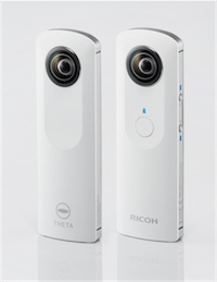
Ricoh's $400 Theta is an innovative gadget that allows you to capture 360° spherical panoramas with just a single click of a button. Now Ricoh has teamed up with Google to allow you to actually do something with those panoramas—put them up on Google Maps and Google+.
This new feature comes through Ricoh making its images compatible with Google's Photo Sphere XMP format, which is natively used in a number of Android phones. Updated software for iOS, Android, and computers now means that the Theta can save its photospheres in this format, and upload them to Google Maps or Google+. You can then link multiple of these panoramas together to create your own street view, which Google calls a "constellation".
So that means you can wonder around your neighborhood, your favorite park, or anywhere else you might like, snapping pictures of your most-loved spots. Then you can upload them to Google Maps, and make your own, private walking tour. If you have friends coming to visit you in your city, you could put together a Google Street View tour and set of directions so they know what they're looking at.
But, as nice of a feature as this is, $400 is still a very steep price for something that most people can just do with their smartphone, even if that takes a minute compared to the just seconds the Ricoh Theta can do it in.