Aerial photographers: This clever map will help you steer clear of no-drone zones
posted Friday, July 25, 2014 at 4:19 PM EDT
The rise of affordable multicopters and radio-controlled aircraft with built-in cameras (or support for mounting your own) has brought aerial photography within reach of the masses, but it's proven to be a thorny issue where the US government is concerned. As use of unmanned aerial vehicles -- or drones, in mainstream media parlance -- soars, so too do bans on UAV operations.
Whether it's the FAA, the National Park Service, or local lawmakers, government agencies are lining up to forbid the public from flying in particular areas. There's little question that at least some of these bans on the use of drones are necessary. After all, the meeting of a drone and a commercial jet could have tragic consequences, so it's only logical that there are restrictions near airports to prevent a collision.
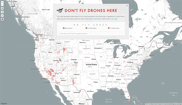
But how do you know whether you're allowed to fly your UAV in any given area? A beautifully-presented and rather clever new new map on open-source cartography site Mapbox.com aims to help you find the answer. The logically-titled "Don't Fly Drones Here" map allows you to browse the contiguous United States, zooming and panning to see areas where drone use is prohibited. While Alaska is included in the data set, the map tries to prevent you panning there, bouncing back to the contiguous US as soon as you let go of your mouse button. We're guessing that's because its makers don't have access to complete info for Canada, Mexico and the rest of the world, and so have tried to lock the map to the USA, unintentionally leaving Alaskans out in the cold.
Of course, even within the USA, the map is only as good as its data sources -- and so it has to be seen more as a list of places where it's not safe to fly, rather than an indication of where you can use your drone. (And that's tacitly acknowledged by the use of a negative in the map's name.)
Straight away, we realized that only fairly large airports are included, for example. The FAA's guidance is that even noncommercial drone use is legal only if you're inside Class G airspace, flying at less than 400 feet above ground, and more than five miles from "any airport or other location with aviation activities". That definition would include everything from a helipad or grass strip to an international airport, and so even though the Don't Fly Drones Here map doesn't show these minor airports, airfields and helipads nationwide, it's wise to be cautious and stay away from them. And the map doesn't attempt to include local or state government bans either.
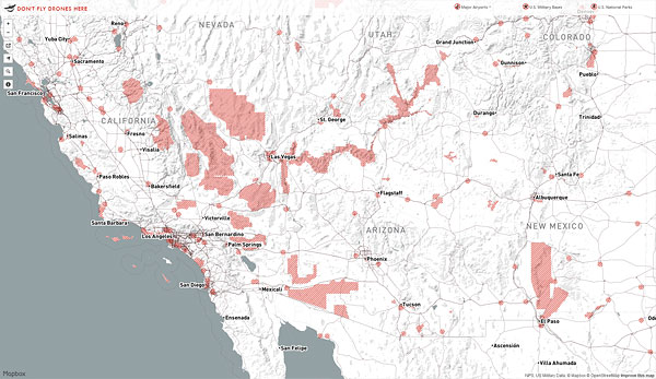
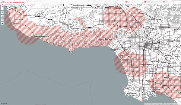
But while you can't treat the map as a definitive authority on where you can fly, it's an excellent tool for determining where you definitely can't. The map includes larger US airports, zones in which the military doesn't allow flights to take place, and also the confines of all national parks. (Only some of these actually forbid drone flight at the current time, but all will in fairly short order.) If the location in which you're planning to fly is marked with red hatching on the "Don't Fly Drones Here" map, there's a very good chance that a flight will land you in hot water -- and so you'll know that it's time to move on and find another site!
(via PopPhoto)