|
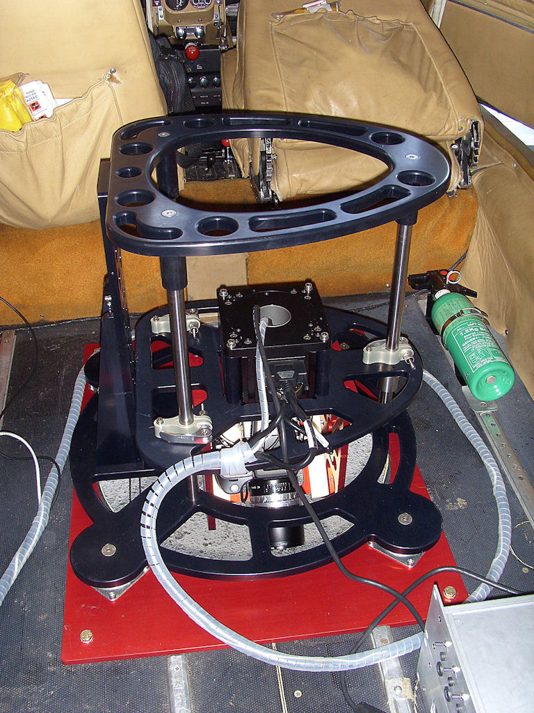
Hartley Wintney, June 30th 2009 - Getmapping has released details of its new ‘AZICAM’ oblique camera system. The system is used to capture sharp full colour oblique digital images of towns and cities. When combined with traditional vertical imagery and desktop software users have a rich multidimensional viewing environment, that can be explored, measured and even exported for use in presentations or as building blocks for full 3D modelling. Getmapping are providing an all in one service to capture, process and supply imagery and software. Developed over the last two years in close collaboration with Bath Spa University the Azicam takes a radical approach to oblique image capture. Instead of a normal four camera array used to take North, South, East and West (90°) orientations, the Azicam is a single medium format digital camera mounted on a rotating plate or ‘spinner’ driven by a precise friction motor to orient the camera for each shot. Navigational and recording GPS ensures accurate geo-location. The Azicam system has several advantages. Using a single higher resolution camera delivers a wider area of coverage, better image quality and costs less to calibrate and maintain. The whole system will fit in an aircraft already configured for a single vertical camera installation. “The Azicam system which we have co-developed makes the best use of available aircraft, is easy to maintain and delivers superior imagery at less cost. It also allows us to offer a complete oblique imagery service at a price that won’t break the bank,” said Tristram Cary, Managing Director of Getmapping. “Combined with existing vertical imagery and using MultiVision software, users can view any feature such as a building from 5 different angles simultaneously. The built in tools make it possible to ascertain building heights, calculate elevation areas and the distance between features. The system is completely proven and we already have customers who are delighted with the results,” continued Cary. “We have around 30 users of oblique imagery and MultiVision software, which is now in everyday use,” said James Rutter, GIS Manager at Surrey Heath Borough Council, one of the first recipients of Azicam data. “The imagery has multiple uses including planning site visits, looking to see how many floors buildings have for rate calculations, understanding street/industrial estate geography for street naming and numbering, measuring areas of land for enforcement purposes, measuring building heights for 3D modelling and much more. It has become indispensable,” continued Rutter. -end-
About Getmapping Plc www.getmapping.com (First posted on Tuesday, June 30, 2009 at 13:46 EDT) |