Google Earth offers incredible before and after shots of landscapes hit by disaster
posted Tuesday, September 3, 2013 at 1:16 PM EDT
While many of us may use Google Earth to whistfully stare at tropical islands on a dreary Monday morning, it can actually give us a pretty impressive look into the past, too. Google Earth is capable of swapping back and forth between historical and modern images, a tool the folks over at Mashable have used to put together 11 impressive comparisons of disasters and developments that have radically altered the landscapes.
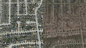
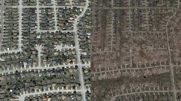
For instance, the shot below is of Moore, Oklahama, showing the devastation of the May 20th tornado.
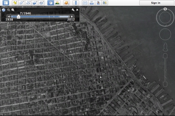
If you're interested in doing this sort of comparison on your own, all you need to do is fire up a copy of Google Earth, and look for the clock icon in the top menu. It'll let you pull up a slider of historic imagery that you can go through, ranging from monthly satellite photos from the last couple of years, all the way back to the early 20th Century.
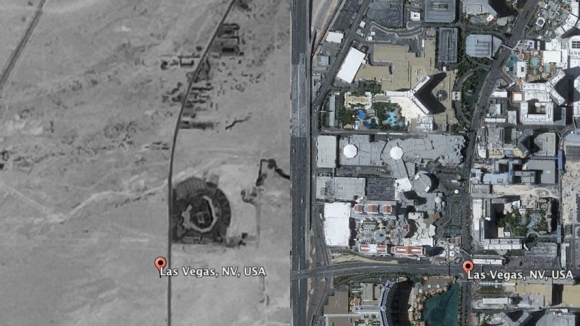
Because the historical data stretches back so far, you can use it for some dramatic comparisons of how areas have changed, like this image of Las Vegas from before it was built up to its current state.
It's a great way to look at how your neighborhood has changed over the years, or even if it's stayed much the same. Why not take it for a spin, and let us know in the comments if you see anything particularly interesting?