Stunning underwater panoramas expose reefs at risk
posted Monday, October 7, 2013 at 1:05 PM EDT
Coral reefs are incredibly delicate ecosystems, and ones that are under a huge amount of threat at present. A new project undertaken by a group of research institutes is aiming to standardize chronicling the current state of the reefs — by capturing astonishing panoramas of them the world over.
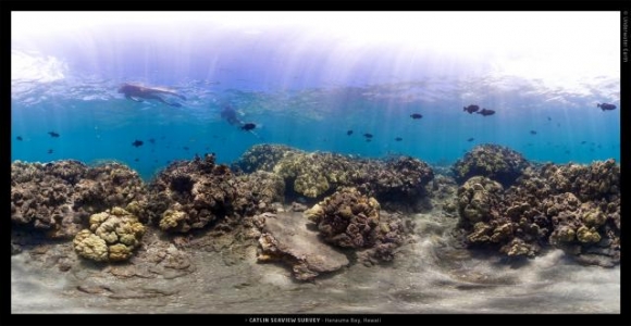
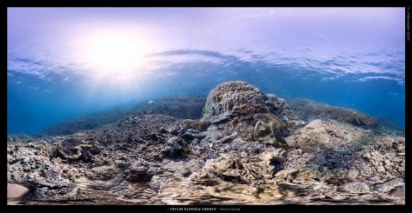
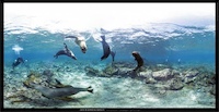
The Catlin Global Reef Record is an attempt to create a standard way study, record, and monitor the incredibly endangered reefs. This is being done by the Catlin Seaview Survey, creating an enormous source of photographic and reference data that can be used by scientists, environmentalists, and policy makers to see what's going on in the world beneath the waves — and also shows the rest of us what's being destroyed.
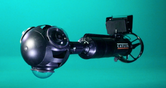
The project records the reefs using a specially designed rig dubbed the Catlin Seaview SVII. It has an array of three cameras that capture a 360° panorama, controlled by an Android tablet. The rig has a depth sensor, and each survey follows the contours of a reef at 10 meter intervals, capturing panoramas at three second intervals. This allows a 2km stretch of reef to be recorded in every dive. So far 192km (around 120 miles) of reef have been recorded, and there's plenty more that need doing.
The images are then stitched together, annotated by experts, and a computer system is being trained to try and help identify what's seen in all the images.
As for the panoramas themselves, you can check them out on the Reef Record's data page, and each transect contains hundreds of images, GPS information, temperature, and more. You can also see more of the images at the panorama image gallery, which shows off some of the more impressive photos.
(via PetaPixel)